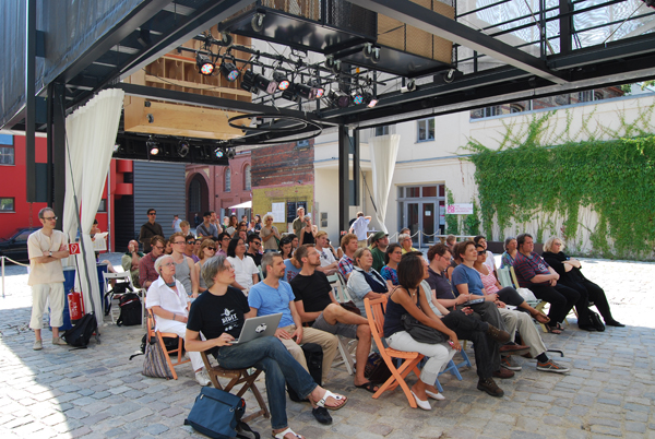
As already indicated in the previous number of our magazine, we will continue to present the events we took part in during the BMW Guggenheim Lab programme in Berlin. On 27 July, the MIT SENSEable City Lab team led by Carlo Ratti organized a workshop in Alexanderplatz which took several hours and was dedicated to the smart monitoring of public space. According to the information presented by the team members in the introduction to the event, the monitoring is part of the cognitive mapping culture of urban space based on the research of Kevin Lynch, a town-planner from the ‘50-‘60s (essential for the academic tradition of MIT).
Since now we have much more sophisticated environment data survey, interpretation and communication means, cartography can be developed in the much more complex context of urban information. Electronic sensors have become an extension of the observer, allowing for new insights into the way people come to appropriate or not the space they use. Thus, the permanent collection of data represents a first step in the more serious process of rethinking the city and taking decisions in order to transform public space. The spectacular graphs and imagery associated to analysis and interpretation correspond to the general tendencies related to cyberculture which flourished rapidly after 2000 in most architecture schools. Nevertheless the experiments of the Boston team start from and are based on concrete, every day experience involving all senses (be they ludic, like in the case of the workshop organized in Alexanderplatz).
We insisted on presenting the Berlin events in the context of other recent projects of the group, developed in Europe and America which provide a pertinent (and no less spectacular) solution for the concept of smart city. Thus, “The Copenhagen Wheel” is not only an engineering reinvention of the bicycle wheel, but it moreover involves new city cartographies and new forms of public interaction in the social networks. “MatchingMarkets” – a project developed in the South Tyrol communities – focuses on urban life mechanisms, including specific agricultural activities, seasonal tourism and digital communication. Finally, “TraskTrack” and “Backtalk” are mapping by geolocation the space of electronic waste, cassation and recycling of outdated electronic devices.
It is perhaps too early to ask ourselves what the role played by these “electronic maps” will be in city planning with its regulations, architecture codes and urban design. We may conclude however that MIT SENSEable City Lab pursuits a promising activity at the border between city planning, architecture, design, engineering, sociology, economics, marketing, space politics, computer science, telecommunications, journalism and artistic happening, in a space where creative “blending” gives constantly birth to responsible ideas and maybe a new transdisciplinary approach. (C.C.)
Sense and the City: Dynamic Public Spaces Workshop at BMW Guggenheim Lab Berlin
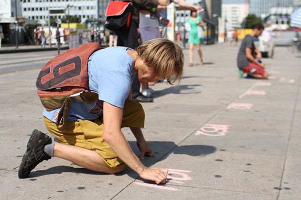
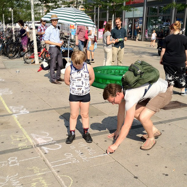
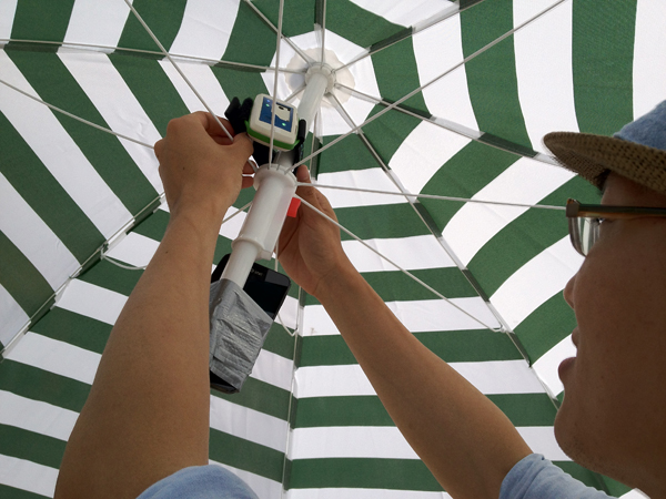
In this workshop held by the MIT SENSEable City Lab in Alexanderplatz, Berlin, in collaboration with the Austrian Institute of Technology, participants experimented with changing public spaces with the help of image processing, environmental sensors, and social media analysis (video analysis software: SLR-Engineering). The workshop provided an introduction to theories and models of how people move, talk and interact in public space, and how this information can lead to a better design for public spaces.
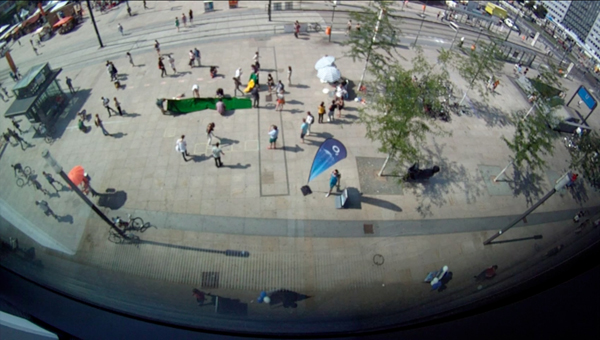
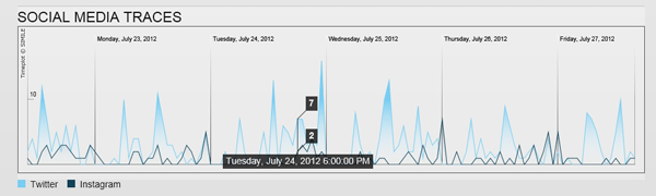
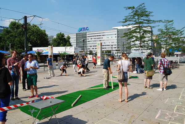
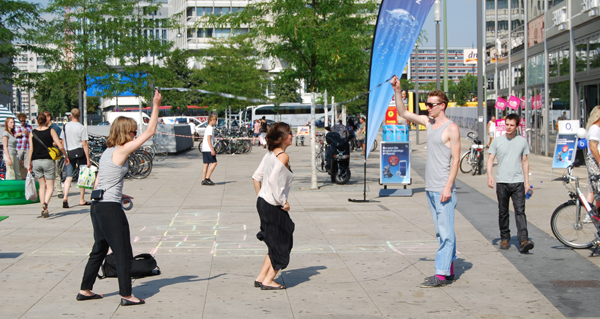
The first half of the workshop took place in a public space near the pavilion; participants had the opportunity to transform the space using a variety of objects and marking tools. Cameras and mobile sensors captured the activity as it happened, while servers collected social media traces in real-time.
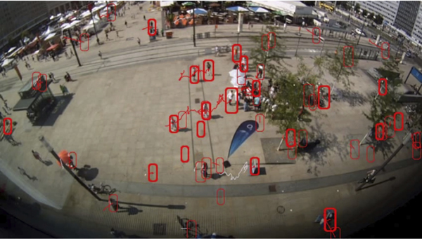
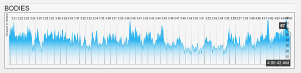
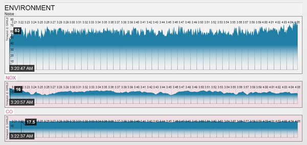
Afterward, we returned to the pavilion to analyze the information collected in the space. We demonstrated how image processing can detect pedestrian paths, behaviors, and group dynamics automatically. We also visualized the noise, pollutant, and social media data, shown in the graphs below, and invited participants to interpret these results.
Credits & info:
Place: Alexanderplatz, Berlin, Germany
Date:July, 27th, 2012
Project authors: Senseable City Lab (Carlo Ratti – director, Assaf Biderman – assoc. director, Dietmar Offenhuber – researcher, David Lee – researcher, Anthony Vanky – researcher, Kael Greco – researcher, Prudence Robinson – researcher)
Austrian Institute of Technology: Katja Schechtner, Stefan Seer
Additional support: Adam Pruden, Till Nagel
Video analysis software: SLR-Engineering